Neighborhood guide · West
Grassland.
The village between Franklin and Brentwood that neither one annexed. Five miles of Hillsboro Road north of the Mack Hatcher loop, a 1784 land grant, a ten-room house that gave the place its name, two schools and a 76-acre ball park at Manley Lane, two shopping strips that lost their grocery in 2018, and around it the 1960s subdivisions on acre lots that made the pocket what it is. This guide is Grassland from the city line to the Davidson County line: River Rest and the Harpeth side, the Sneed Road ridge, the Del Rio and Old Hillsboro corner, Battlewood and the strip, and Berry's Chapel. What an acre with a 1968 brick ranch costs and what a 2006 river lot costs, why the county rate is the whole tax bill, which streets go to Grassland Elementary and which to Walnut Grove, why the sewer plant in River Rest is the story of the year, what 18,000 cars a day on two lanes feel like at 7:45, and what Brentwood's August annexation hearing means for the line.
B-roll · coming soon
Neighborhood video. Ninety seconds of B-roll: the Sneed Road signal at 7:40 on a school morning with the middle-school line backed past the park, six diamonds lit at Grassland Park on a Tuesday in April, the Good Cup's counter at 6:15, the Leaton house behind its cedars at Manley Lane, a grinder-pump lid in a Farmington front yard, Old Natchez Trace under the trees to the Harpeth, and the Battlewood strip at dusk with the fireworks stand lit. No narration.
01 · The place
A farm crossroads that two cities grew toward and stopped at, and the schools that made it a place.
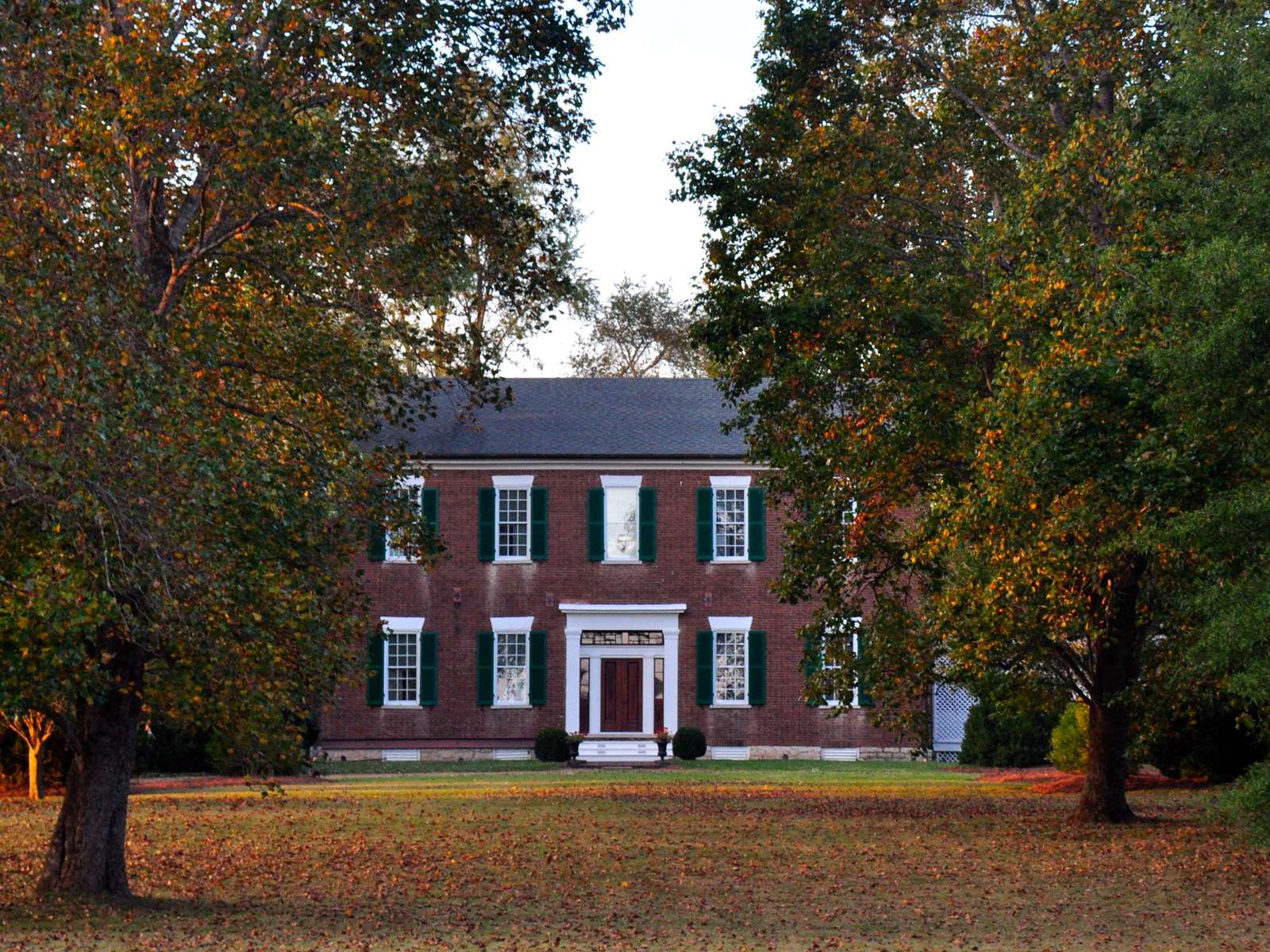
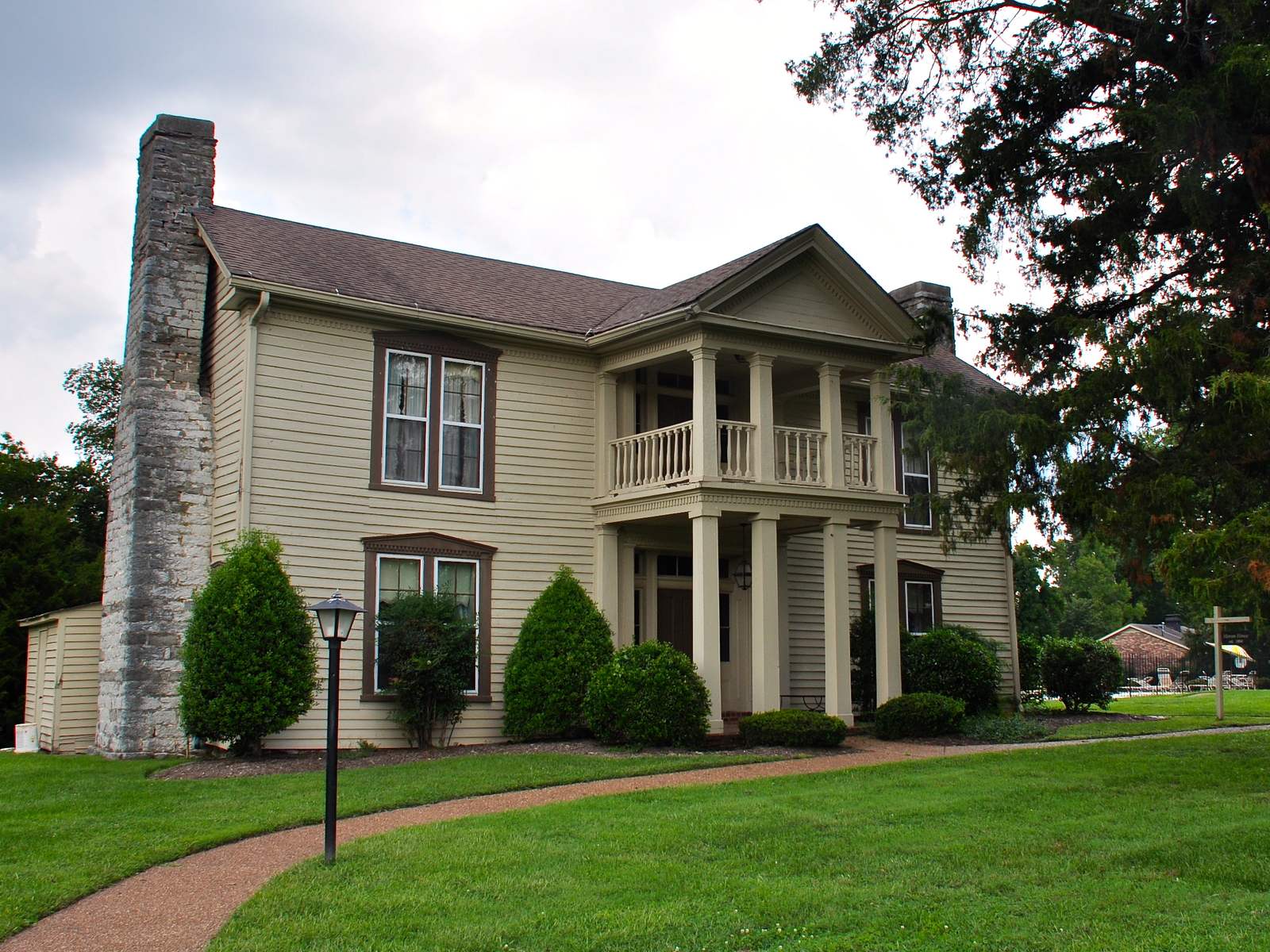
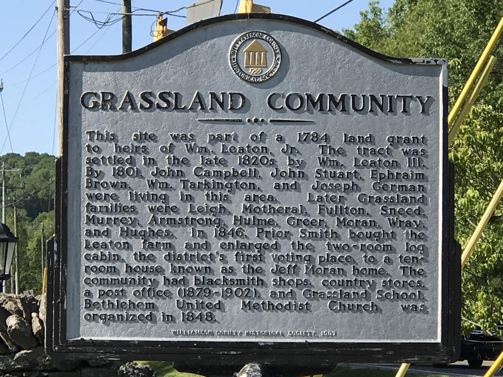
The land was a 1784 grant to the heirs of William Leaton Jr., and William Leaton III settled it in the late 1820s, but people were already there: the county's marker at Hillsboro Road names Campbell, Stuart, Brown, Tarkington, and German as living here by 1801, and then Leigh, Motheral, Sneed, Moran, Greer, and Hughes, which is why the roads are named what they are. In 1846 Prior Smith bought the Leaton farm and enlarged its two-room log cabin, the district's first polling place, into a ten-room house he called Grassland. The house is still there, inside the River Rest subdivision, and the name outlived the farm. There were blacksmiths, country stores, a school, a post office from 1879 to 1902, and Bethlehem Methodist from 1848, whose fish fry is now in its sixth decade. The Leaton house itself, a frame house from about 1802 with an 1850 Greek Revival front, sits behind its cedars at Manley Lane on the National Register, across the road from the schools that took the name.
What Grassland is now was decided between 1960 and 1992. The Grassland Estates and Meadowgreen subdivisions started in the early 1960s on three-quarter-acre to two-acre lots with septic tanks, Hillsboro Acres and Farmington followed on the same terms, and River Rest went in across from the school in the late 1970s with its own sewer plant. Then the county built the elementary school on Manley Lane in 1992 and the middle school next to it, laid 76 acres of ball fields between them, and a pocket of subdivisions on a state highway became the place that a whole side of the county says it is from. Franklin's boundary came up Hillsboro Road and stopped a few hundred feet past Mack Hatcher; Brentwood's stopped at its own west line; and the county drew a 400-acre village around the schools and the two shopping strips in 2014 and wrote its zoning in 2015. The village itself has about 77 residents and 35 businesses. The Grassland everyone means is the several thousand houses around it.
The market is the 37069 zip's, minus the gates: 302 sales in a year at a $935,000 median and $347 a foot, a median 42 days to contract at 96.5 percent of the first asking price, and 46 percent of sales over a million. Inside the pocket the spread is a 1968 brick ranch on an acre in Grassland Estates at $630,000 and a 2006 river lot in River Landing at $1.6 million, with Hillsboro Acres, Farmington, and Battlewood in between at $776,000 to $968,000. The lot is the product. So is the address: a Franklin one for most of it, a Brentwood one for the rest, and a county tax bill for all of it, which on the median house is about $3,040 a year against $3,660 inside Franklin and $5,240 inside Franklin's special school district.
Who moves here
Families who chose the schools, which are the best-ranked K-8 cluster in the county with a public high school that U.S. News puts tenth in the state: 99.3 percent of the zip's sales are in the Franklin High zone, and the MLS compiler's note says so on every page. People who want an acre and a 1960s house they can rebuild without a homeowners' association, which most of the older streets do not have. Nashville commuters who would rather drive Hillsboro Road into Green Hills in 14 minutes than sit on I-65, and who found that Brentwood charges $1.49 and Franklin $1.566 for a shorter version of the same drive. Parents at Grassland Athletic Association, which has run baseball, softball, basketball, football, and cheer since 1987 and fills the park every weeknight from March. And the buyer who wants, specifically, no city: no city permit, no city stormwater fee, no city short-term rental ordinance, and a sheriff's deputy rather than a police department.
What it is not
Walkable, serviced, or finished. Hillsboro Road is two lanes carrying 18,000 to 19,000 cars a day at the last state count, with one signal in the village and a bike lane that ends where the shoulder does; the county's plan was written on the assumption it may never be widened. The grocery closed in January 2018 and Tractor Supply took the space; the pharmacy closed later; the nearest supermarket is Publix at Fieldstone Parkway, and the nearest library is Franklin's. There is no county trash pickup. A third of the pocket is on septic, a third is on a City of Franklin pressure line with a grinder pump in the yard, and River Rest is on a private plant that put half a million gallons of raw sewage into the Harpeth and Cartwright Creek in 2025 and is asking the state to get bigger. Brentwood has scheduled a hearing to annex 77 acres at the north end. None of this is hidden; all of it is in the disclosures.



02 · The pockets
One road, five sides of it, and three kinds of sewer.
Grassland is sold by subdivision, and most of the subdivisions are 1960s to 1980s streets of a few dozen houses on acre lots with no association. The columns that matter are the decade, which predicts the septic tank, and the side of Hillsboro Road, which predicts the elementary school. Every point below was reverse-geocoded and came back Williamson County only; the pocket is entirely outside both cities as of September 2026.
| Where, and when | What you find | Last 12 months | |
|---|---|---|---|
| The village core, and River Rest1975–1992 · Grassland Elementary · Hillsboro Road at Manley Lane | Hillsboro Road from the slopes north of Manley Lane south past Sneed Road; River Rest across from the schools; Grassland Park behind them | The county's 400-acre village: Grassland Elementary, opened on Manley Lane in August 1992, and Grassland Middle beside it; the 76-acre park with six diamonds and six tennis courts; the Leaton house; Station 22 and the convenience center on Sneed Road. River Rest is the 1970s subdivision that owns the community: 185 houses and 120 condos, two pools, tennis, a playground, the 1846 Grassland house inside it, and the private sewer plant on Treatment Plant Road that serves it and the village core. | River Rest houses 9 · $725K median · $288–$438 / sq ft · $75 / mo; condos 3 · $335K · $410–$430 / mo |
| The Sneed Road ridge1976–2001 · Grassland Elementary · west of Hillsboro Road | Sneed Road from Hillsboro Road west toward Old Natchez Trace: Sneed Forest, the Gardens at Old Natchez, the Old Natchez estates, and the gated communities beyond | Sneed Forest's 1976-to-1988 houses on one to 1.3 acres with no association to speak of; the Gardens at Old Natchez, 1999-to-2001 garden homes on a quarter to half an acre beside Old Natchez Country Club with club-adjacent dues of $640 to $760 a year; the Old Natchez estates on Lawrence Road and the Trace on multiple acres. Past them, Laurelbrooke, Legends Ridge, and Temple Hills, which the gated guide covers. Sneed Road carried 11,580 cars in 2015, up from 7,530 in 2000, and the county projects 20,000 by 2030. | Sneed Forest 2 · $1.19M median; Gardens at Old Natchez 3 · $1.4M; Old Natchez top sale $2.7M |
| The Harpeth side1800–2019 · Grassland Elementary · Old Hillsboro Road and Del Rio Pike | Old Hillsboro Road from the Hillsboro Road junction west to the river: River Landing, Hillsboro Cove, Whitehall Farms, Meeting-of-the-Waters, Moran Road | River Landing, 2000 to 2006 in 11 sections on a third to half an acre with 125 acres of green space and river trail, dues $62 to $95 a month by section, and the Highgrove customs above it; Whitehall Farms, about 18 customs from around 2000 on one to three acres, septic with city water, $180 a year; Hillsboro Cove, 20 one-acre lots on 34 acres platted in 2013 over floodplain objections, 5,300 to 7,200 square feet from 2015 to 2019, listed at $2.9 million to $3.35 million and unsold in a year. Meeting-of-the-Waters, about 1810 on 18 acres at the fork of the two Harpeths, and the Motheral house on Moran Road, both on the Register. The 2010 flood crested at 35.32 feet on the Franklin gauge; ask for the elevation certificate. | River Landing 9 · $1.6M median · $302–$368 / sq ft; Whitehall Farms 2 · $1.35M; Hillsboro Cove 0 closed, listed $2.9M–$3.35M |
| Battlewood, and the strip1961–1986 · Grassland or Walnut Grove · Hillsboro Road south of the village | Hillsboro Road from Bethlehem Loop south to Del Rio Pike: Battlewood Estates, Grassland Estates, Hillsboro Acres, Farmington, Meadowgreen, Brownwood, and the two shopping strips | The Grassland most people mean. Grassland Estates from 1960 to 1975 on three-quarter-acre to two-acre lots, septic, no association and no architectural review; Hillsboro Acres from 1964 to 1968 on half an acre to an acre, no association; Farmington from 1979 to 1986 on an acre with $75 a year; Battlewood from 1970 to 1986 on an acre and up; Meadowgreen on Stable Road, 1961 to a 2022 infill. Battlewood Shopping Center at 2176 Hillsboro Road, where Food Lion became Grassland Market became Foodland became, in 2018, Tractor Supply; Grassland Station across the road, 20,000 square feet listed for sale. Hillsboro Acres, Farmington, Meadowgreen, and Brownwood have been on the City of Franklin's pressure sewer since 2011. | Hillsboro Acres 8 · $776,500; Meadowgreen 4 · $822,500; Farmington 5 · $950K; Battlewood 4 · $967,500; Grassland Estates 4 · $630K |
| Berry's Chapel, and the Brentwood side1895–2026 · Walnut Grove or Grassland · east of Hillsboro Road | North and South Berrys Chapel Roads, Lynnwood Way, and Old Hickory Boulevard: Cottonwood, Foxen Canyon, Chapelwood, Stonebridge Park, and the 2057 Hillsboro Road tracts | Berry's Chapel Church of Christ, 1895, which baptized in the river until 1956; Cottonwood at Moores Lane, 484 houses from 1975 to 1984 on a quarter acre with a pool, a clubhouse, and $88 a month, the pocket's fastest market at four days to contract, which the Cool Springs guide covers; Foxen Canyon, Turnberry's 49 lots from 2018 on South Berrys Chapel Road at $100 a month; Chapelwood's four-acre estates; Stonebridge Park off Old Hickory Boulevard, 1996 to 2006 on a third of an acre at $1,100 a year. The 33.5 acres at 2057 Hillsboro Road are for sale in four tracts from $2 million each, sewer to be installed by the buyer, and Brentwood has scheduled a hearing on annexing 77 acres west of Hillsboro Road at Old Hickory Boulevard for 25 lots and a sewer pump station. | Cottonwood 14 · $949,250 · 4 days; Stonebridge Park 9 · $1.3M; Foxen Canyon 1 · $1.95M; Chapelwood 1 · $2.9M, 105.5% of ask |
Sources: MLS closed sales, trailing 12 months to summer 2026, as compiled by nashvillehome.guru for River Rest, River Landing, Farmington, Hillsboro Acres, Meadowgreen Acres, Grassland Estates, Battlewood Estates, Sneed Forest, Hillsboro Cove, Whitehall Farms, Chapelwood, Foxen Canyon, Stonebridge Park, the Gardens at Old Natchez, Old Natchez, and Cottonwood (its Cottonwood cut runs to May 2026); the River Rest association's November 2025 comment letter for its house and condo counts; the county's Grassland Village Special Area Plan for the village boundary and the park; the county's 2016 corridor study and TDOT's traffic history for the Sneed Road counts; Williamson Source and the Williamson Herald on Hillsboro Cove (2013 and 2014) and on the Brentwood annexation hearing (August 2026); the National Weather Service on the 2010 crest. Jurisdiction from Overpass point checks on 20 streets, September 8, 2026. Bands are for choosing a street, not pricing a house; several of these cuts are two to five sales.
03 · Homes & market
What a house costs, and what you get for it.
The 37069 zip closed 302 arm's-length sales in a year at a $935,000 median, a $347 median foot, a median 2,999 square feet on 0.42 acres, and a median build year of 1996. That zip also holds Fieldstone Farms inside the city and the gated estates up Old Hillsboro Road, so the pocket's own numbers are the subdivision cuts: $630,000 to $968,000 for a 1960s-to-1980s house on an acre, $1.3 million to $1.6 million for a 1996-to-2006 house on a third, and $1.95 million to $2.9 million for the handful of new or estate sales. Only 6 percent of the zip's sales were built in this decade. What you are buying is the lot and the school; the house is often the 1968 original.
Sources: MLS closed sales, trailing 12 months to summer 2026, as compiled by nashvillehome.guru for the 37069 zip (302 arm's-length sales) and by subdivision for Grassland Estates, Hillsboro Acres, Farmington, River Landing, Chapelwood, and the others in the pockets table. The zip figures include Fieldstone Farms, inside Franklin, and the gated estates the gated guide covers; the subdivision cuts are the pocket. Homes.com and Zillow polygons for "Grassland" were not used. The compiler refreshes monthly and its 37069 page has carried both 287 and 302 sales this year; figures move.
| Tier | What you get | Typical range |
|---|---|---|
| The condoRiver Rest's attached section | A 1975-to-1976 townhouse of 1,200 to 2,000 sq ft on Boxwood Drive with the two pools and the tennis courts, $410 to $430 a month, and the plant's sewer bill. The only way into the Grassland schools under $500,000. | $310K–$460K |
| The acre with a ranchGrassland Estates, Hillsboro Acres, Meadowgreen, River Rest's houses | A 1961-to-1980 all-brick ranch or split-level of 1,500 to 3,300 sq ft on half an acre to two, a septic tank or the 2011 city line, no association or a $75 one, and a lot you can add to. Four of Grassland Estates' sales, eight of Hillsboro Acres'. | $600K–$950K |
| The acre, built outFarmington, Battlewood, Sneed Forest, Cottonwood | A 1976-to-1988 two-story of 2,300 to 4,200 sq ft on an acre or more, or a 1980s Cottonwood house on a quarter acre with the pool and clubhouse that sells in four days. The renovated 1960s ranch lands here too. | $900K–$1.5M |
| The 2000s lotRiver Landing, Stonebridge Park, Gardens at Old Natchez, Whitehall Farms | A 1996-to-2006 brick house of 3,000 to 6,600 sq ft on a third of an acre to three, with an association of $180 to $1,140 a year and, in River Landing, the river trail; Whitehall Farms is the one on septic. The tier that sells at $300 to $400 a foot. | $1.2M–$2.4M |
| The estate, or the new houseFoxen Canyon, Chapelwood, Old Natchez, Hillsboro Cove, the 2057 Hillsboro tracts | Turnberry's 2018-and-later houses at Foxen Canyon; a four-acre Chapelwood estate that sold in a day; the Old Natchez houses around the club; Hillsboro Cove's 5,300-to-7,200-square-foot customs on the river that list near $3 million and have not closed in a year; or eight acres of the 2057 Hillsboro Road tract from $2 million before the house and the sewer. | $1.95M–$3.35M |
- The 1960s brick ranchGrassland Estates, Hillsboro Acres, Meadowgreen: a long low all-brick house with a carport or a side-entry garage, a picture window, 1,500 to 2,400 sq ft on a slab or a crawlspace, on three-quarters of an acre with mature hardwoods. The pocket's native house, and the one the renovators buy for the lot.
- The 1970s split and the 1980s colonialRiver Rest, Farmington, Battlewood, Sneed Forest: split-levels and two-story brick colonials of 2,300 to 4,200 sq ft, a formal dining room, a bonus room over the garage, on an acre with a long drive. Farmington's have a grinder-pump lid in the front yard since 2011.
- The River Rest townhouseThe 1975-to-1976 attached houses on Boxwood Drive, the only condos in the pocket: two stories, a patio, the pool across the lane, and the association that has spent 2025 fighting the sewer plant on everyone's behalf.
- The 2000s traditionalRiver Landing, Stonebridge Park, the Gardens at Old Natchez: brick and stone, a two-story foyer, a main-floor primary, 3,000 to 6,600 sq ft on a third of an acre or less, with the green space and the trail doing the work the acre used to.
- The river customHillsboro Cove, Whitehall Farms, Highgrove: 4,000 to 7,200 sq ft on an acre or three above the Harpeth, a walkout basement, a screened porch to the water, and a floodplain map you should read before the finishes. Hillsboro Cove's six floodplain lots were the argument in 2013.
- The Register houseThe Leaton house at Manley Lane, Meeting-of-the-Waters on Del Rio Pike, the Motheral house on Moran Road, the 1846 Grassland house inside River Rest: log, brick, and frame from 1802 to 1850, on the National Register since 1982 and 1988, and privately owned. The county has no demolition-permit rule for a historic house; the owner is the protection.
| Line item | Notes | 2026 rate or cost |
|---|---|---|
| Williamson County property tax | Assessed at 25% of appraisal. The unincorporated rate, and the whole bill; no city, no special district. Set in June 2025 after the reappraisal, down from $1.88 | $1.30 per $100 |
| HOA dues | None in Grassland Estates, Hillsboro Acres, Meadowgreen, Battlewood, and most of Sneed Forest; Farmington $75 a year; Whitehall Farms $180; the Gardens at Old Natchez $640–$760; Stonebridge Park about $1,100; River Rest houses $75 a month, condos $410–$430; River Landing $62–$95 by section; Foxen Canyon and Cottonwood $88–$100 a month | $0–$5,200 / yr |
| Septic | Grassland Estates, Sneed Forest, Battlewood, Whitehall Farms, Hillsboro Cove, and most 1960s lots: an individual system permitted by the county's Sewage Disposal office on West Main Street. A new or larger system needs a soil evaluation first; a failed one on a lot near the 2011 line is a mandatory tap | Inspection at sale; pump every 3–5 years |
| The Franklin pressure sewer | Hillsboro Acres, Farmington, Meadowgreen, and Brownwood: the City of Franklin's small-diameter line, available since August 22, 2011, a grinder pump at each house, a per-lot assessment payable through the county trustee, and since August 2018 a Franklin sewer bill on every assessed lot whether or not it tapped | Assessment balance, plus the city bill |
| The River Rest plant | River Rest and the village core: the private plant on Treatment Plant Road, Limestone Water's since December 2021, billed as a utility. It reported spills of about 200,000 gallons in March 2025, 57,000 in April, and 300,000 in July, and has a pending state permit to expand from 0.25 to 0.45 million gallons a day; rates are set by the Tennessee Public Utility Commission, with a filing docketed in July 2026 | Utility rates; ask for the last 12 bills |
| Water | The City of Franklin supplies the village on six- to 16-inch mains, and the subdivisions along Hillsboro Road; the west side toward Old Hillsboro Road is H.B.&T.S. Utility District territory. Confirm the provider by address | City or district rates |
| Garbage collection | No county pickup. A private hauler by subscription, or the Grassland Convenience Center at 1495 Sneed Road behind the fire station: weekdays 9 to 5, weekends 7 to 3 since July 2026, three cubic yards a day, residents only, free | Quoted by hauler, or your truck |
| Fire insurance | Williamson Fire-Rescue's Station 22 at 1493 Sneed Road West; the 2014 ISO survey moved Grassland from Class 6/9 to 5/5X, effective August 1, 2014. No newer rating was published; ask the carrier by address, and by distance to a hydrant | Quoted by address |
| Impact fees and taxes on a new house | The county's privilege tax at $2.00 a sq ft and its education impact fee, $1,681 to $12,399 by size, $12,399 at 3,400 sq ft and up. No city fee; there is no city | $10,000–$21,000 |
Worked example on the zip's $935,000 median: assessed $233,750. County $3,039 = about $3,040 a year in property tax, nothing else. The same house would pay about $3,660 inside Franklin outside the FSSD, about $5,240 inside it, and about $3,480 in Brentwood. A Hillsboro Acres house at $776,500: assessed $194,125; about $2,525, plus the Franklin sewer bill and whatever is left of the assessment. A River Landing house at $1.6 million: assessed $400,000; about $5,200, plus about $950 in dues. Sources: Williamson County 2026 rates and combined totals ($1.30 county only; Franklin $1.566 outside the FSSD and $2.2433 inside; Brentwood $1.49); the county's Meadowgreen-Grassland sewer archive and FAQ; the Williamson Herald (February 2026) and WSMV, NewsChannel 5, and Williamson Source (2025) on the Limestone plant; the Grassland Village plan on water; the county's convenience-center page; Williamson Source (April 2014) on the ISO change; tnimpactfees.com; nashvillehome.guru on dues.
04 · The village, and its rules
What the county's village district allows, what the sewer decides, and where the cities stop.
Grassland has no government of its own, and the rules that shape it come from four places: the county's 2014 village plan and the zoning it produced in 2015, the county's rural-preservation districts around that, three separate sewer arrangements, and two city boundaries that have crept toward it for 60 years. As of September 2026:
| Question | The answer | What it means for you |
|---|---|---|
| The village districtGVC1 to GVC4, since October 2015 | The county's 2007 land-use plan named Grassland one of its four designated villages, with College Grove, Leiper's Fork, and Triune. The Grassland Village Special Area Plan, adopted by the planning commission on March 13, 2014 and endorsed by the county commission on May 12, covers about 400 acres and 87 parcels along Hillsboro Road from the slopes north of Manley Lane to the Battlewood strip, in four character areas: the school-and-park hub, the Old Hillsboro Road gateway, the residential middle, and the commercial node. The zoning that followed in October 2015 sets a one-acre minimum lot and one house an acre in all four, allows townhouses at three to six an acre on the flatter ground, caps everything at two stories with a 5:12 roof pitch on Hillsboro Road, and holds every building 50 feet back from it. The plan says it is not meant to bring new development, only to shape it if it comes. | The strip can be rebuilt as a two-story village; it cannot become Cool Springs. Nothing new goes closer than 50 feet to the road. |
| The land around itRP-5, RP-1, SIC, NC | Outside the village the county's ordinance applies: Rural Preservation at one house per five acres on undeveloped land west of I-65 since the 2020 density cut, one per acre where RP-1 was already platted (Hillsboro Cove), and Suburban Infill and Neighborhood Conservation districts over the existing subdivisions, which keep them at their platted density. Parcel-level districts are on the county's GIS viewer, not on the listing. | Your neighbor's acre cannot be split in most of the pocket. A farm can, at one house per five acres or a clustered subdivision on part of it. |
| Sewer, the Franklin lineSince August 2011 | Franklin's board approved a small-diameter pressure sewer for Hillsboro Acres, Farmington, Meadowgreen, and Brownwood in December 2008 after septic failures, and connections opened August 22, 2011. A tap was voluntary unless the septic failed, but every assessed lot began receiving a Franklin sewer bill 84 months later, in August 2018, connected or not. The assessment is collected by the county trustee. The city that does not tax you sends you a sewer bill. | On those four streets, budget a grinder pump, the city's bill, and the assessment balance. Ask whether the house ever tapped. |
| Sewer, the River Rest plantLimestone Water, the pending permit | A 1970s plant on Treatment Plant Road inside River Rest, discharging through Cartwright Creek to the Harpeth, serves River Rest's 305 units and the village core. Cartwright Creek Utility sold it to Limestone Water, part of Central States Water Resources, in December 2021. It has been out of compliance since at least 2009 and has paid more than $100,000 in fines; in 2025 it reported about 200,000 gallons of raw sewage to the Harpeth in March, 57,000 in April, and about 300,000 into Cartwright Creek and the park off Recreation Road in July. Limestone's draft state permit would expand it from 0.25 to 0.45 million gallons a day with a membrane process new to Tennessee; the state took comment through February 21, 2026 and held a hearing on February 11, where the River Rest association asked for denial until the collection system is fixed. The decision was pending at press time, and a rate docket was filed with the state utility commission in July 2026. | If the house is in River Rest or the village core, read the association's letter, the state's draft permit, and the last year of bills before you write the offer. A bigger plant is a bigger neighbor. |
| Septic, everywhere elseThe county's program | Grassland Estates, Sneed Forest, Battlewood, Whitehall Farms, Hillsboro Cove, and the 1960s lots not on the Franklin line are on individual systems. Williamson is one of nine Tennessee counties that runs its own septic program; the Sewage Disposal office on West Main Street issues the permits, and a new or enlarged system needs a soil evaluation first. Cartwright Creek's floodplain runs parallel to Hillsboro Road through the village, which limits where a field can go. | An addition with a bedroom is a septic question before it is a building question. Get the permit file with the disclosure. |
| Short-term rentalsNot a listed use since 2017 | The county's 2013 ordinance allowed vacation rental homes only inside the Leiper's Fork Village district and grandfathered operators elsewhere; in 2015 the codes office told the rest they were illegal, and the ordinance's change log then deleted the use and its definition in September 2017. The county's current page says only to call its Business Tax Department, which collects the hotel-motel tax, and the state's 2018 act limits new local bans on existing operators. | Two phone calls before you underwrite it: Planning, and Business Tax. A Grassland house is a house. |
| The city linesFranklin stops; Brentwood is moving | Franklin's boundary crosses Hillsboro Road a short distance north of Mack Hatcher and every point north of Del Rio Pike checked is county; the city's 2024 growth-plan update moved its urban growth boundary in Goose Creek and on the west side, not here. Brentwood's commissioners scheduled a hearing in August 2026 on annexing 76.72 acres west of Hillsboro Road and south of Old Hickory Boulevard for a 25-lot subdivision with 32 acres of open space, plus an 18-acre parcel for a sewer pump station. It had not been approved at press time. | A Brentwood line inside the pocket would bring Brentwood's $1.49 and its sewer to the north end. Everyone else stays at $1.30 until a city asks and a majority says yes. |
| The roadSR 106, two lanes, no funded project | Hillsboro Road is State Route 106 and U.S. 431: two lanes carrying 17,905 cars a day north of Bethlehem Loop and 18,869 south of Manley Lane at the 2015 state count, with a bike lane through the village and few sidewalks. TDOT approved a planning report in 2019 for four lanes from Highway 96 to Del Rio Pike, on the Franklin side. The county's 2016 15-year plan drew a four-lane Sneed Road from Timberlane to Hillsboro Road, added turn lanes at the Sneed signal, and a roundabout on Lynnwood Way at Farmington Drive, $23 million and $7 million, unfunded. The realignment of the Old Hillsboro Road junction went to bid in October 2022 at $2.9 million; every bid was rejected that November and no award has been published. | Drive it at 7:40 on a school day before you decide. The county's own plan assumes it stays two lanes. |
In one line
The county zones it, three different pipes drain it, and two cities have stopped at its edges for 60 years, one of them now with a hearing on the calendar. The rules are why an acre is still an acre here; the sewer is why you should read them.
05 · Schools
Two elementaries split by street, one middle school, and the county's original high school.
The cluster is the reason the pocket exists as a market. Grassland Elementary on Manley Lane, a 2022 National Blue Ribbon school, or Walnut Grove Elementary on Stable Road, a 2024-25 Reward School, depending on which side of which street the house is on; then Grassland Middle on Hillsboro Road, in the middle of a $7 million renovation; then Franklin High two miles south, U.S. News' tenth-ranked high school in Tennessee. The compiler puts 99.3 percent of the zip's sales in the Franklin High zone. No rezoning on the district's five-year plan touches any of the four.
| School | Grades | Neighborhoods | Notes |
|---|---|---|---|
| Grassland Elementary6803 Manley Lane · WCS | K–5 | River Rest, Grassland Estates, Battlewood, Sneed Forest, River Landing, the Old Hillsboro and Sneed Road side, Hunterwood, and the gated communities north of the loop | About 460 students at 15 to 1; a 2022 National Blue Ribbon School; U.S. News' 14th elementary in Tennessee; 81 to 84 percent proficient in math, English, and science against a state rate in the 40s. The school dates to the 1873 Sunnyside School on Hillsboro Road, took the Grassland name in 1911, moved to Bethlehem Loop in 1950 and to Manley Lane in August 1992. A Brentwood 37027 address. The district's capital plan has a $6 million renovation in fall 2032 and a new roof bid in February 2026. |
| Walnut Grove Elementary326 Stable Road · WCS | K–5 | Meadowgreen and the Stable Road side, Cottonwood, the Berry's Chapel streets nearer Franklin, and Fieldstone Farms inside the city | About 560 students; a 2024–25 Reward School; U.S. News' 20th elementary in the state, Niche's 15th, SchoolDigger's 14th of 1,009. Has a pre-K. A $6 million renovation is on the district's plan for fall 2030. |
| Grassland Middle2390 Hillsboro Road · WCS | 6–8 | Everything in this guide, and the gated communities | About 800 students at 15 to 1; Niche's 14th middle school in Tennessee, U.S. News' 19th, SchoolDigger's 11th of 583. Over capacity with a portable in 2014; no newer capacity figure was published. A $7 million interior renovation was bid in January 2026 and awarded to Grace Construction, running through fall 2028. |
| Franklin High810 Hillsboro Road · WCS | 9–12 | Every Grassland Middle address, plus part of the Franklin Special School District's Freedom and Poplar Grove middle schools | About 1,730 students at 16 to 1 against a 1,800 capacity; U.S. News' 10th high school in Tennessee and 442nd nationally, 64 percent AP participation; a 2024–25 Reward School; the state's first IB program. Founded 1910; the current building opened in January 2006 and the annex, the old Columbia State campus, in January 2018 with 16 classrooms. Not open-zoned; for 2026–27 the district gave Freedom Middle eighth-graders zoned here first claim on Centennial's 157 open seats, which is the pressure valve. |
Sources: Grassland Elementary's own history page; NCES, U.S. News, Niche, SchoolDigger, and Public School Review for enrollment, ratios, proficiency, and rankings; the National Blue Ribbon program (2022); Williamson Source (November 2025) on the district's 35 Reward Schools; the district's five-year capital plan (November 2024) and its purchasing page on the Grassland Middle renovation, the elementary roof, and the 2030 and 2032 projects; the Williamson Herald (2014) on the middle school's capacity and on Franklin High's 1,800; Williamson Source and the Herald (January and February 2026) on open zoning; Wikipedia on Franklin High's buildings; nashvillehome.guru on the Hunterwood and Cottonwood zones. The elementary line runs between streets and the district's maps are PDFs; confirm any address with the WCS zone finder.
- Battle Ground AcademyFranklin's PK–12 independent on Mack Hatcher, 12 minutes down Hillsboro Road; the private school most of the pocket means.
- Christ Presbyterian Academy & Currey IngramCPA on Old Hickory Boulevard at the top of the pocket, ten minutes up Hillsboro Road; Currey Ingram on Murray Lane in Brentwood for learning differences, the closest campus of any of them.
- Ensworth & the Highway 100 schoolsEnsworth's high school on Highway 100 by Warner Park is 11 minutes free-flow by Old Natchez Trace and Sneed Road; Harpeth Hall, MBA, and Franklin Road Academy are 20 to 25 through Green Hills. The reason a Nashville private-school family lives in Grassland instead of Franklin.
- Grace Christian, Franklin Classical & New HopeGrace Christian Academy on Southall Road, Franklin Classical on Windcross Court, and New Hope Academy's PK–6 in Franklin, at a third to half the independent-school price.
- Grassland Day SchoolAt Grassland Heights Baptist, 2316 Hillsboro Road: 15 months through pre-K, two-, three-, and five-day options, 9 to 2, licensed for 99, a security officer on site. The village's own preschool since 2007.
- Mustard Seed & BethlehemMustard Seed Preschool at Christ Community Church, 1215 Hillsboro Road, since 2004, ages three to five, Tuesday to Friday; Bethlehem United Methodist's preschool on Bethlehem Loop Road, ages one to five.
- The district's pre-KWalnut Grove has a pre-K classroom; WCS Voluntary Pre-K seats are by application each spring, placed in the elementaries with demand, and age four by August 15. The Primrose schools are in Cool Springs and East Franklin; there is no chain on Hillsboro Road.
06 · Getting around
The drive, honestly timed.
Times are from Hillsboro Road at Manley Lane, in front of the schools, on a weekday morning between 7 and 8:30. River Landing and the Old Natchez Trace ridge add five to nine minutes to everything but Westhaven and Ensworth; Cottonwood and Battlewood subtract two from Franklin. Three ways out: Hillsboro Road south to the square and Mack Hatcher, Hillsboro Road north through Green Hills to I-440 and downtown, or Moores Lane east to I-65. The school drop-off line at Sneed Road and Manley Lane is the local variable, 7:15 to 8 and 2:45 to 3:45.
Mobility scores
River Rest can walk to the schools and the park, and the village core can walk to the Good Cup and the strip if it crosses a two-lane highway to do it; the county's plan counts few sidewalks and asks for crosswalks at Battlewood and Bethlehem Loop that have not been built. Everywhere else is a car.
A bike lane runs on Hillsboro Road through most of the village and ends with it; Old Natchez Trace, Moran Road, and Del Rio Pike are the rides, narrow and shaded and without a shoulder. The Natchez Trace Parkway's north end at Highway 100 is 15 minutes by car with the bike on the rack.
None. Franklin Transit stops at the city line; WeGo's Hillsboro Pike route ends in Green Hills.
Two lanes, 18,000 to 19,000 cars a day, two schools and a ball park on one intersection, and a Sneed Road that has grown 54 percent since 2000 and is projected to grow 45 percent more. The pain is the Sneed signal at 7:40 and 3:15, the left turn out of any subdivision onto Hillsboro Road, and Green Hills at 5:30 on the way home. It does not lock up the way Mack Hatcher does; it never clears the way Leiper's Fork does.
07 · Daily life
Where the week actually happens.
- The Daily Dish2205 Hillsboro Road: the caterer since 1990 that reopened as the village's full-time room in 2021, meat-and-three, sandwiches, soups, and the pocket's lunch table.
- Nashville Pizza CompanyIn the Battlewood center since June 1997, and Great Wall of China three doors down: the two rooms that survived the grocery, the drugstore, and the cleaners.
- Barbara's Home CookingOn Old Hillsboro Road at the gateway, the country-cooking room the county's own villages feature calls famous; call first.
- Sonic, and the fireworks standThe drive-in on Battlewood Drive, and the seasonal stand at Battlewood and Hillsboro that opens in June, for the record.
- Green Hills, and Main StreetThe pocket eats out in two directions: Green Hills 14 minutes north, downtown Franklin 11 south. We track the shows nightly.
- Bethlehem's fish fryThe third Friday of July at the 1848 church on Bethlehem Loop Road, all-you-can-eat catfish and a band, 50 years running in 2025. The one night the whole pocket eats together.
- The Good Cup2181 Hillsboro Road, Grassland's living room since Anne Sale opened it in 2003, owned by its longtime barista Amanda Taylor: weekdays 6 to 3:30, Saturday from 6:30, kitchen until 2, closed Sunday. The GAA board meets here whether it means to or not.
- Hillsboro Road's other cupsNothing else in the pocket; the next espresso is at Fieldstone Parkway with the Publix, or Green Hills.
- The Coffee AtlasTwenty Franklin shops, ranked by the community, 11 minutes south.
- Groceries, in two directionsNone in the pocket since Foodland closed in January 2018. Publix Harpeth Village at 2020 Fieldstone Parkway, a minute off Hillsboro Road, and Kroger at 595 Hillsboro Road by Mack Hatcher; Publix Cool Springs Festival on Moores Lane for the east side.
- Battlewood Shopping Center2176 Hillsboro Road: Tractor Supply in the old grocery, the contract post office inside the Grassland Market, Grassland Dentistry, Truist across the way at 2184, First Horizon's Grassland branch. The Rite Aid and the cleaners are gone; Grassland Station across the road is for sale.
- The convenience center1495 Sneed Road, behind Station 22: the county's trash and recycling drop, oil, e-waste, mattresses, and a Goodwill trailer, weekdays 9 to 5 and weekends 7 to 3. The Saturday-morning errand that replaces the truck.
- The vetLittle House Animal Hospital in the white clapboard house at 1109 Battlewood Street, Dr. Kunkel's since 2000 after eight years of house calls; Pet Vet on the same street.
- The county, and City HallPermits, the septic office, the assessor, and the planning commission are on West Main Street in Franklin, 12 minutes. There is no town hall; there is a Farm Bureau. We cover the county, and Franklin's City Hall for the neighbors who have one.
- Storefronts we've profiledLocal businesses, one at a time.
- Grassland Park76 county acres at Hillsboro Road and Manley Lane: six ball diamonds, six tennis courts, multipurpose fields, a pavilion, a playground, walking trails, and the Sensory Garden for the Blind. The Grassland Athletic Association's home since the park opened, and the loudest place in the pocket on a spring weeknight.
- The Franklin Recreation ComplexThe county's center at 1120 Hillsboro Road just inside the loop: the indoor lap pool, the outdoor pool and splash park, the gym, weekdays from 5 in the morning, and a Harpeth canoe access behind it.
- The HarpethRiver Landing's 125 acres of green space and trail along the river; the fork at Meeting-of-the-Waters; the city's launches at the Rec Complex, Harlinsdale, and Pinkerton downstream. The Franklin gauge's record is 35.32 feet in May 2010, and the Limestone plant discharges above all of it.
- Jim Warren, Harlinsdale & PinkertonFranklin's parks, 10 to 14 minutes south: Jim Warren's 12 diamonds on Boyd Mill Avenue, Harlinsdale's 200 acres, and Pinkerton's lit mile loop.
- The Trace, and Timberland ParkThe Natchez Trace Parkway's north end at Highway 100 is 15 minutes by Old Natchez Trace and Sneed Road; Timberland Park's 72 acres and trails at milepost 437 are 20. The double-arch bridge at 438 is closed for work until spring 2027.
- The three clubsOld Natchez Country Club off Sneed Road, Temple Hills on Temple Road, and Vanderbilt Legends' 36 holes on Legends Club Lane, all private, all in 37069, none in this guide's price band without the initiation.
- Heritage Medical, GrasslandThe pediatric practice at 2339 Hillsboro Road, open until 7 on Mondays; and Grassland Dentistry in the Battlewood center. The two doctors' offices in the pocket.
- Williamson Medical CenterThe county hospital and 24-hour ER at Carothers and Mack Hatcher, 13 minutes by Moores Lane; Vanderbilt's own is 21 up Hillsboro Road.
- Walk-in careWilliamson Health's clinics in Brentwood on Pewitt Drive, in Franklin on Murfreesboro Road, and in Cool Springs on McEwen, 7:30 to 7:30 on weekdays; nothing walk-in on Hillsboro Road. Vanderbilt primary care on Old Hickory Boulevard at the Shoppes at Brentwood.
- The gymThe county's Rec Complex on Hillsboro Road for the pool and the weight room. The Maryland Farms YMCA in Brentwood closed in August 2026 and the Y calls it a transition; check what replaced it before you count on it.
- Working from homeHalf the pocket does. The subdivisions along Hillsboro Road have cable and, in parts, fiber; the ridges toward Old Natchez Trace and the river bottoms are their own problem. Test the cell signal in the house, not the driveway.
- The libraryFranklin's main library on Columbia Avenue, 14 minutes; Brentwood's own library on Concord Road is a city library and a similar drive. No county branch in the pocket.
08 · The year
What the pocket does together.
Grassland's calendar is the park's and the churches', and then Franklin's. The pocket's own dates, and the city ones that pull it south:
- FebruaryThe out-of-zone windowWCS takes out-of-zone applications from February 4 to April 15, with a lottery on April 16 if a school is oversubscribed, and no bus for the winners. Franklin High is not on the open list; Centennial's seats are the valve.
- MarchGAA opening dayBaseball and softball at Grassland Park from March; football and cheer in August, basketball in the school gyms through the winter. The association has run since 1987 on fees, sponsors, and parents, ages four to 18.
- AprilMain Street FestivalThe Heritage Foundation's 42nd was April 25 and 26, 2026, on Franklin's Main Street, 11 minutes south.
- MayThe Franklin RodeoMay 14 to 16, 2026 at the Williamson County Ag Expo Park, the pocket's biggest night out with the kids.
- JuneThe fireworks standGrassland Fireworks opens at Battlewood and Hillsboro Road for the season; the Fourth itself is Franklin's, or a driveway.
- JulyBethlehem's fish fryThe third Friday of July at Bethlehem United Methodist on Bethlehem Loop Road, 4 to 8, all-you-can-eat catfish, a band, and a kids' area; the 50th was July 18, 2025 at $18 in advance. July 17 in 2026, by the pattern.
- SeptemberNo Pilgrimage this yearThe festival at Harlinsdale drew 27,000 in 2025 and announced in March that it would skip 2026 and return in 2027; the last weekend of September is quiet on Hillsboro Road for once.
- DecemberFranklin's parade, and DickensThe Rotary's Christmas parade on Main Street the first Saturday of December, and Dickens of a Christmas the second weekend; the pocket drives down, and the tree lighting is at the churches.
09 · Trade-offs
The case for, and the case against.
What you gain
- The schools, at the county rate. A Blue Ribbon elementary or a Reward School, a top-15 middle school, and the state's tenth-ranked public high school, on a $1.30 bill: about $3,040 on the median house against $5,240 for a Franklin house inside the special district.
- An acre. Three-quarters to two acres under a 1960s house in Grassland Estates and Hillsboro Acres, with no association and no review board, at $630,000 to $776,500 at the median. The cheapest acre with these schools in the county.
- Two cities, no city. Eleven minutes to the square, 14 to Green Hills, 15 to I-65, and a sheriff's deputy rather than a police department; the permit office is the county's and the short-term rental ordinance is Franklin's problem.
- The park. Seventy-six acres, six diamonds, six courts, and an athletic association that has fielded the pocket's kids since 1987, across the road from both schools.
- A place with a name. A 1784 grant, an 1802 house on the Register, a marker at the signal, a church with a 50-year fish fry, and a coffee shop that has been the living room since 2003. Not a subdivision that borrowed a name; a community that the subdivisions moved into.
What you give up
- The road. Two lanes, 18,000 to 19,000 cars a day, one signal, two schools and a ball park on it, a county plan that assumes it stays that way, and a junction realignment whose bids were all rejected in 2022.
- The sewer. Septic on the acre lots, a grinder pump and a Franklin bill on four streets, and a private plant in River Rest with half a million gallons of 2025 spills and a pending permit to grow. Three arrangements, none of them simple, all of them in the disclosure.
- Service. No grocery since 2018, no pharmacy, no library, no trash pickup, no bus, a strip for sale, and a 1,300-student school pair whose middle school was over capacity in 2014.
- The 1968 house. Most of the pocket's stock is 50 to 60 years old on a septic tank, and the renovation is the second purchase. Only 6 percent of the zip's sales were built this decade, and the new ones start at $1.95 million.
- The line. Franklin's boundary is a few hundred feet away and Brentwood has a hearing on the calendar for 77 acres at the north end. The county rate is a fact today and an assumption in ten years.
The verdict
Buy the lot and the zone, and inspect the pipe. Grassland Estates or Hillsboro Acres if the reason is an acre under $800,000 with these schools and you can live in, or rebuild, a 1960s house; Farmington or Battlewood if it is the acre with a bigger house and you have priced the grinder pump; River Landing if it is a 2000s house and the river trail and dues are fine; River Rest if it is walking to the school and the park, once you have read what the association wrote to the state. Whatever the reason, get the septic file or the sewer bills with the disclosure, confirm the elementary zone by street, drive Hillsboro Road at 7:40 on a school morning, and ask the county what Brentwood's hearing decided, because that is the one thing in this guide that changes the tax bill.
10 · Map
Where it sits.
Hillsboro Road from the Mack Hatcher loop north to Old Hickory Boulevard and the Davidson County line, between Brentwood's west line and the Harpeth. The village and the schools are at Manley Lane and Sneed Road; the Battlewood strip is a mile and a half south at Bethlehem Loop; Old Hillsboro Road leaves west from the village toward the river, Del Rio Pike, and Leiper's Fork; Sneed Road leaves west toward Old Natchez Trace and the gated communities; Moores Lane leaves east from Cottonwood toward I-65.
11 · Questions
What people ask before they move here.
Is Grassland part of Franklin or Brentwood?
Neither. Grassland is unincorporated Williamson County: a Franklin mailing address and the 37069 zip for most of it, a Brentwood 37027 address for some of it, including Grassland Elementary, and no city government for any of it. Franklin's boundary crosses Hillsboro Road a short distance north of Mack Hatcher and stops; every subdivision north of Del Rio Pike that we checked came back county only. Brentwood's line stops at its own west edge. The county zones it under its 2015 village district and its rural districts, the sheriff patrols it, Williamson Fire-Rescue's Station 22 on Sneed Road answers the fire call, the county's convenience center behind the station takes the trash, and the county's Sewage Disposal office permits the septic. In August 2026 Brentwood's commissioners scheduled a hearing on annexing 76.72 acres west of Hillsboro Road and south of Old Hickory Boulevard for a 25-lot subdivision and a sewer pump station; it had not been approved at press time, and it would be the first city line drawn inside the pocket.
What is the property tax?
$1.30 per $100 of assessed value for tax year 2026, the Williamson County rate alone, set in June 2025 after the reappraisal, with no city and no special school district on top of it. Assessment is 25 percent of appraisal, so the 37069 zip's $935,000 median sale pays about $3,040 a year; a $776,500 Hillsboro Acres house about $2,525; a $1.6 million River Landing house about $5,200. The same $935,000 house would pay about $3,660 inside Franklin outside the special school district at $1.566, about $5,240 inside it at $2.2433, and about $3,480 in Brentwood at $1.49. Lots in Hillsboro Acres, Farmington, Meadowgreen, and Brownwood also carry the City of Franklin's 2011 sewer assessment through the county trustee and a Franklin sewer bill since 2018, which is the one way the city that does not tax you sends you a bill.
Which schools, and which elementary?
Grassland Elementary on Manley Lane or Walnut Grove Elementary on Stable Road, depending on the street; then Grassland Middle on Hillsboro Road and Franklin High two miles south for nearly everyone. Grassland Elementary is a 2022 National Blue Ribbon School and U.S. News' 14th elementary in Tennessee, about 460 students at 15 to 1, with the Sneed Road, Old Hillsboro Road, River Rest, and Battlewood sides; Walnut Grove, a 2024–25 Reward School ranked 20th, takes Meadowgreen, Cottonwood, and the streets nearer Franklin. Grassland Middle is Niche's 14th middle school in the state, about 800 students, and in a $7 million interior renovation through fall 2028. Franklin High is U.S. News' tenth high school in Tennessee, about 1,730 students against a 1,800 capacity, 64 percent AP participation, and the state's first IB program; the MLS compiler puts 99.3 percent of the zip's sales in its zone. The district's five-year plan builds new schools to the east, south, and west and rezones none of these; confirm any address with the WCS zone finder, because the elementary line runs between streets.
Sewer or septic, and what is the story with the plant?
Three answers by subdivision. The 1960s-to-1980s streets on acre lots, Grassland Estates, Sneed Forest, Battlewood, Whitehall Farms, and Hillsboro Cove among them, are on individual septic systems permitted by the county, with a City of Franklin or utility-district water meter at the road. Hillsboro Acres, Farmington, Meadowgreen, and Brownwood were retrofitted by the City of Franklin in 2011 with a small-diameter pressure sewer that needs a grinder pump at every house, carries a per-lot assessment, and has billed every assessed lot since August 2018 whether it tapped or not. River Rest's 305 units and the village core drain to a private plant on Treatment Plant Road inside River Rest, built in the 1970s, owned since December 2021 by Limestone Water, out of compliance since at least 2009, which reported about 200,000 gallons of raw sewage to the Harpeth in March 2025, 57,000 in April, and about 300,000 into Cartwright Creek and the park in July. Limestone has asked the state to expand it from 0.25 to 0.45 million gallons a day; the state held a hearing on February 11, 2026, the River Rest association asked for denial until the collection system is repaired, and the decision was pending in September, with a rate case filed in July. Ask which of the three the house is on before the inspection, and get the file.
Can I rent it on Airbnb?
Probably not as a matter of right, and ask the county before you underwrite it. The county's zoning ordinance, effective January 2013, allowed short-term vacation rentals only inside the Leiper's Fork Village district and grandfathered operators elsewhere as nonconforming; in 2015 the codes office told the rest of the unincorporated county they were illegal and sent cease-and-desist letters, and the ordinance's own change log then deleted the use and its definition in September 2017, so it is not a listed use anywhere in the county now. The county's current page says only to call its Business Tax Department, which collects the hotel-motel tax on short-term rentals, and Tennessee's 2018 Short-Term Rental Unit Act limits new local bans on existing operators. The Planning office and the Business Tax Department are the two calls; a listing's claim is not a permit, and a subdivision's covenants, where there are any, are a third rule.
How bad is Hillsboro Road?
Two lanes carrying 17,905 cars a day north of Bethlehem Loop and 18,869 south of Manley Lane at the 2015 state count, the most recent published, past two schools with about 1,300 students and a 76-acre ball park, with one signal at Sneed Road, a bike lane through the village, and few sidewalks. Sneed Road itself carried 11,580 in 2015, up from 7,530 in 2000, and the county's 2016 corridor study projected 20,000 by 2030 and a doubling on Lynnwood Way. That study drew a four-lane Sneed Road from Timberlane to Hillsboro Road, a wider Sneed signal, and a roundabout at Farmington Drive, about $30 million together and unfunded. The realignment of the Old Hillsboro Road junction went to bid in October 2022 at $2.9 million and every bid was rejected. TDOT's approved four-lane plan for Hillsboro Road runs from Highway 96 to Del Rio Pike, on the Franklin side of the line. The county's own village plan was written on the assumption that Hillsboro Road may never be widened through Grassland; the Mack Hatcher extension that opened in November 2021 gave the south end a way around the square, and nothing gave the village a way around the school line.
How does it compare to the gated communities, the Hillsboro Road corridor inside the loop, and Brentwood?
Same schools, three different products. Laurelbrooke, Legends Ridge, and Temple Hills sit on the same $1.30 rate and the same Grassland Middle and Franklin High a few miles west on Sneed Road, with a gate, a club, and a $2.4 million to $3 million median; Grassland is the same zone at $630,000 to $1.6 million with no gate and a 1968 house. Inside the loop, Founders Pointe, Chestnut Bend, and the Hillsboro Road corridor pay Franklin's $1.566 or $2.2433 for city sewer, sidewalks, city parks, and the same high school, 11 minutes closer to the square. Brentwood, across the east line, pays $1.49 for a city with its own police, library, and parks, Brentwood's schools instead of Franklin's, and a quarter-acre where Grassland has an acre. The gated guide, the Hillsboro Road corridor guide, and the Brentwood guide cover the three.
12 · Compare
If you like Grassland, also look at.
Franklin's gated & estate communities.
Laurelbrooke, Legends Ridge, and Temple Hills: the same $1.30 and the same Grassland schools a few miles west, with a gate, a club, and three times the price.
Same schools, with a gateSullivan Farms, Founders Pointe & Hillsboro Rd.
The same road inside the loop: city sewer, sidewalks, and Franklin High, at Franklin's rate, 11 minutes closer to the square.
The city side of the lineBrentwood.
Across the east line: a city with its own police, library, and schools, at $1.49, on a quarter-acre, with the hearing that may move the line.
The other addressSources & method
- Sales, medians, ranges, price per square foot, days to contract, sale-to-list ratios, lot and house sizes, build years, dues, and zones: MLS closed sales, trailing 12 months to summer 2026, as compiled by nashvillehome.guru for the 37069 zip (302 arm's-length sales; its page has also shown 287 this year) and for River Rest, River Landing, Farmington, Hillsboro Acres, Meadowgreen Acres, Grassland Estates, Battlewood Estates, Sneed Forest, Hillsboro Cove, Whitehall Farms, Chapelwood, Foxen Canyon, Stonebridge Park, the Gardens at Old Natchez, Old Natchez, Evergreen Homes Estates, Hunterwood, and Cottonwood (to May 2026). The zip figures include Fieldstone Farms and the gated estates; the subdivision cuts are the pocket, and several are two to five sales. Homes.com and Zillow polygons were not used. The River Rest association's public comment (November 2025) for its 185 houses and 120 condos. CommercialSearch on the 2057 Hillsboro Road tracts (updated September 6, 2026).
- Village facts and history: the county's Grassland Village Special Area Plan (adopted March 13, 2014; endorsed May 12, 2014) for the boundary, acreage, parcels, population, businesses, character areas, water mains, the Cartwright Creek floodplain, the park, and the 1997 historical marker's text; the county's plan page and the 2015 zoning text amendment for the GVC districts (one-acre minimum, 50-foot setback, two stories, 5:12 pitch); Williamson Source (July 2014) and the Williamson Scene (2015 and May 2019) on the village designation, the vote, and the villages feature; the National Register on the William Leaton House (1988), Meeting-of-the-Waters (1982), the John Motheral House (1988), and Old Town Bridge; Wikipedia for each; Grassland Elementary's history page for the 1873, 1911, 1950, and 1992 dates; the Berry's Chapel markers on the 1895 church and 1956 baptisms; the Williamson Herald on Foodland (December 2017) and Tractor Supply (September 2018).
- Jurisdiction: Overpass point checks on September 8, 2026 at River Landing, Cottonwood, Hillsboro Acres, Farmington, Meadowgreen, Whitehall, Battlewood, the strip, Grassland Estates, Manley Lane, River Rest, Sneed Forest, the Gardens at Old Natchez, Stonebridge Park, Hillsboro Road at Old Hickory Boulevard, Old Natchez Trace, Walnut Hills, North Berrys Chapel, and Sawyer Road, all Williamson County only, with Hillsboro Road just north of Mack Hatcher and Windsor Way inside Franklin; Nominatim reverse geocoding for the same; the county's Growth Plan update (November 2024) and Fox 17 on Franklin's boundary change; the Williamson Herald (August 2026) on Brentwood's annexation hearing (76.72 acres, 25 lots, 18-acre pump-station parcel). The OSM line north of Mack Hatcher should be checked against the county GIS before a street-level claim.
- Tax rates and fees: Williamson County 2026 property tax rates page (county only $1.30; Franklin $1.566 outside the FSSD and $2.2433 inside; Brentwood $1.49); tnimpactfees.com and the county's education impact fee page; the Williamson Scene on the June 2025 budget.
- Sewer, septic, water, and services: the county's Meadowgreen-Grassland Area Sewer archive and FAQ (updated February 2017: December 2008 approval, August 22, 2011 availability, the 84-month billing rule, the trustee assessment); the Williamson Herald (February 16, 2026), WSMV (July 25, 2025), NewsChannel 5 (2025 and 2026), Williamson Source (2025), the River Rest association's Substack, and the state utility commission's docket 26-00063 (July 2026) on the Limestone Water plant, its spills, fines, the 0.25-to-0.45 permit, the February 11 hearing, and the comment deadline; the county's Sewage Disposal page; the Grassland plan on City of Franklin water; hbtsud.com and jchengr.com on the H.B.&T.S. district; williamsonready.org and the county on Station 22 and the fire districts; Williamson Source (April 17, 2014) on the ISO 5/5X rating; the county's convenience-center page (hours from July 6, 2026); the county sheriff's patrol page; Williamson Source (August 2015), the ordinance's amendment log (September 11, 2017), and the county's hotel-motel page on short-term rentals; MTAS on the 2018 act; the Williamson Herald (November 2020) on the density change.
- Schools: Grassland Elementary's history page; NCES, U.S. News, Niche, SchoolDigger, Public School Review, and plainschools for enrollment, ratios, proficiency, and rankings; the National Blue Ribbon program (2022); Williamson Source (November 25, 2025) on the district's Reward Schools; the district's five-year capital plan (November 7, 2024) and purchasing page on the Grassland Middle renovation (bid January 2026, Grace Construction, fall 2028), the elementary roof (February 2026), the Walnut Grove (2030) and Grassland Elementary (2032) renovations, and High School West (2031); the Williamson Herald (2014) on Grassland Middle's portable and on Franklin High's 1,800 capacity; Williamson Source (January 22, 2026) and the Herald (February 2, 2026) on open zoning; Wikipedia on Franklin High; wcs.edu on the zone finder and the out-of-zone window; each private school's tuition page or Private School Review; Grassland Day School, Mustard Seed, and Bethlehem on their own pages; wcs.edu on Voluntary Pre-K.
- Roads and commute: TDOT's Traffic History layer (2015 counts on SR 106 north of Bethlehem and south of Manley, SR 46, Sneed Road, Del Rio Pike, Lynnwood Way, and Moores Lane; no newer counts are published in that dataset); the county's 2016 corridor study and the Williamson Scene (August 2, 2016) on the 15-year plan; ConstructConnect on the SR 106/SR 46 realignment (bid October 12, 2022; rejected November 8, 2022); the Williamson Herald on the Mack Hatcher northwest extension (opened November 29, 2021) and on TDOT's Hillsboro Road planning report; the Grassland plan on the bike lane and sidewalks. OpenStreetMap routing (OSRM) free-flow times from Hillsboro Road at Manley Lane and from the Old Natchez Trace ridge, run September 8, 2026, with a weekday 7 to 8:30 a.m. allowance from Google Maps typical traffic; the National Park Service on the Trace bridge closure.
- Daily life and events: Williamson Source (June 22, 2018) and the Good Cup's listings on its history and hours; the Williamson Scene (February 2021) and dailydishcatering.com on the Daily Dish; Nashville Pizza Company's and Great Wall's own pages; Publix, Kroger, Truist, First Horizon, Tractor Supply, and the contract post office listing for addresses; Little House Animal Hospital's page; playgrassland.com on the GAA; Williamson County Parks on the Rec Complex; the county plan and the Scene on Grassland Park and the sensory garden; the City of Franklin on its parks and canoe accesses; Williamson Health on its walk-in clinics; the YMCA's Maryland Farms transition page; the Williamson Herald and bethlehemumc.com on the fish fry (July 18, 2025); the Heritage Foundation on Main Street Festival and Dickens; Visit Franklin on the rodeo; the Williamson Herald (March 25, 2026) on Pilgrimage skipping 2026; Williamson Source on the 2025 parade; the National Weather Service on the May 2010 crest.
- Photographs: Meeting-of-the-Waters (2014) and the William Leaton House (2014) by Skyrunner75, CC BY-SA 3.0, and the Grassland Community marker (2020), CC BY-SA 4.0, all via Wikimedia Commons, cropped to 4:3.